
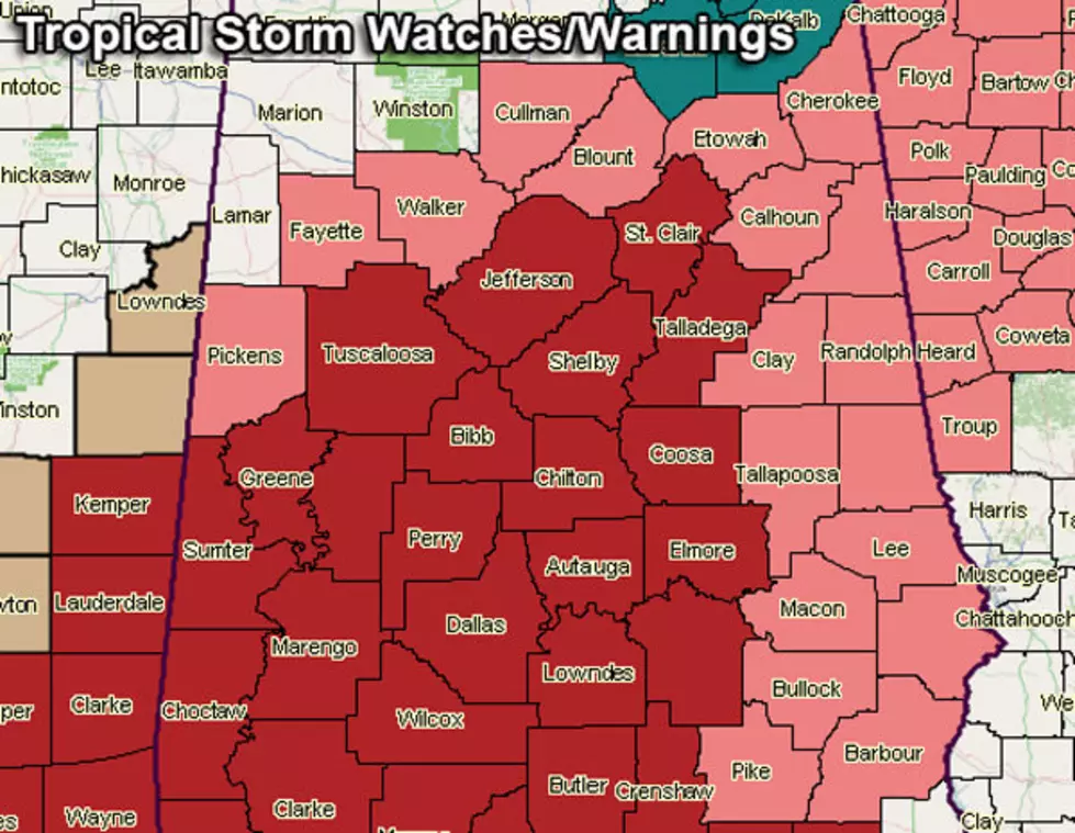
Tropical Storm Warning In Effect for West Alabama; Hurricane Nate Expected to Reach Category 2 Strength Before Landfall
A Tropical Storm WARNING is in effect for our listening area until further notice as Hurricane Nate is forecast to bring heavy rains and winds in excess of 70 miles an hour to West Alabama. The National Weather Service in Birmingham advises you to prepare for the approaching storm and to anticipate widespread power outages. At this time, we anticipate the worst of the storm to be in West Alabama as early as tomorrow (Sunday) morning; however, Nate could move faster than that.
The Tropical Storm Warning is as follows:
...TROPICAL STORM WARNING IN EFFECT...

A Tropical Storm Warning means Tropical storm wind conditions are
expected somewhere within this area and within the next 36 hours

* LOCATIONS AFFECTED
    - Tuscaloosa

* WIND
    - LATEST LOCAL FORECAST: Tropical storm force winds remain
      possible
        - Peak Wind Forecast: 20-30 mph with gusts to 45 mph

    - CURRENT THREAT TO LIFE AND PROPERTY: Moderate
        - The wind threat has remained nearly steady from the
          previous assessment.
        - Emergency plans should include a reasonable threat for
          strong tropical storm force wind of 58 to 73 mph.
        - To be safe, earnestly prepare for the potential of
          significant wind impacts. Remaining efforts to secure
          properties should now be brought to completion.
        - Dangerous wind is possible. Failure to adequately shelter
          may result in injury. Move to safe shelter before the wind
          becomes hazardous.

    - POTENTIAL IMPACTS: Significant

* FLOODING RAIN
    - LATEST LOCAL FORECAST: Flash Flood Watch is in effect
        - Peak Rainfall Amounts: 1-3 inches, with locally higher
          amounts

    - CURRENT THREAT TO LIFE AND PROPERTY: Elevated
        - The flooding rain threat has remained nearly steady from
          the previous assessment.
        - Emergency plans should include a reasonable threat for
          minor flooding where peak rainfall totals are near amounts
          conducive for localized flash flooding and rapid inundation.
        - To be safe, prepare for the potential of limited flooding
          rain impacts.
        - Localized flooding is possible. If flood related watches
          and warnings are issued, heed recommended actions.

    - POTENTIAL IMPACTS: Limited
A Flash Flood Watch is also in effect through 10 p.m. tomorrow (Sunday) night. Take a look at the graphs below for more information on the forecast at this time.
NWS Birmingham
NWS Birmingham
NWS Birmingham
NWS Birmingham
More From 101.7 The River